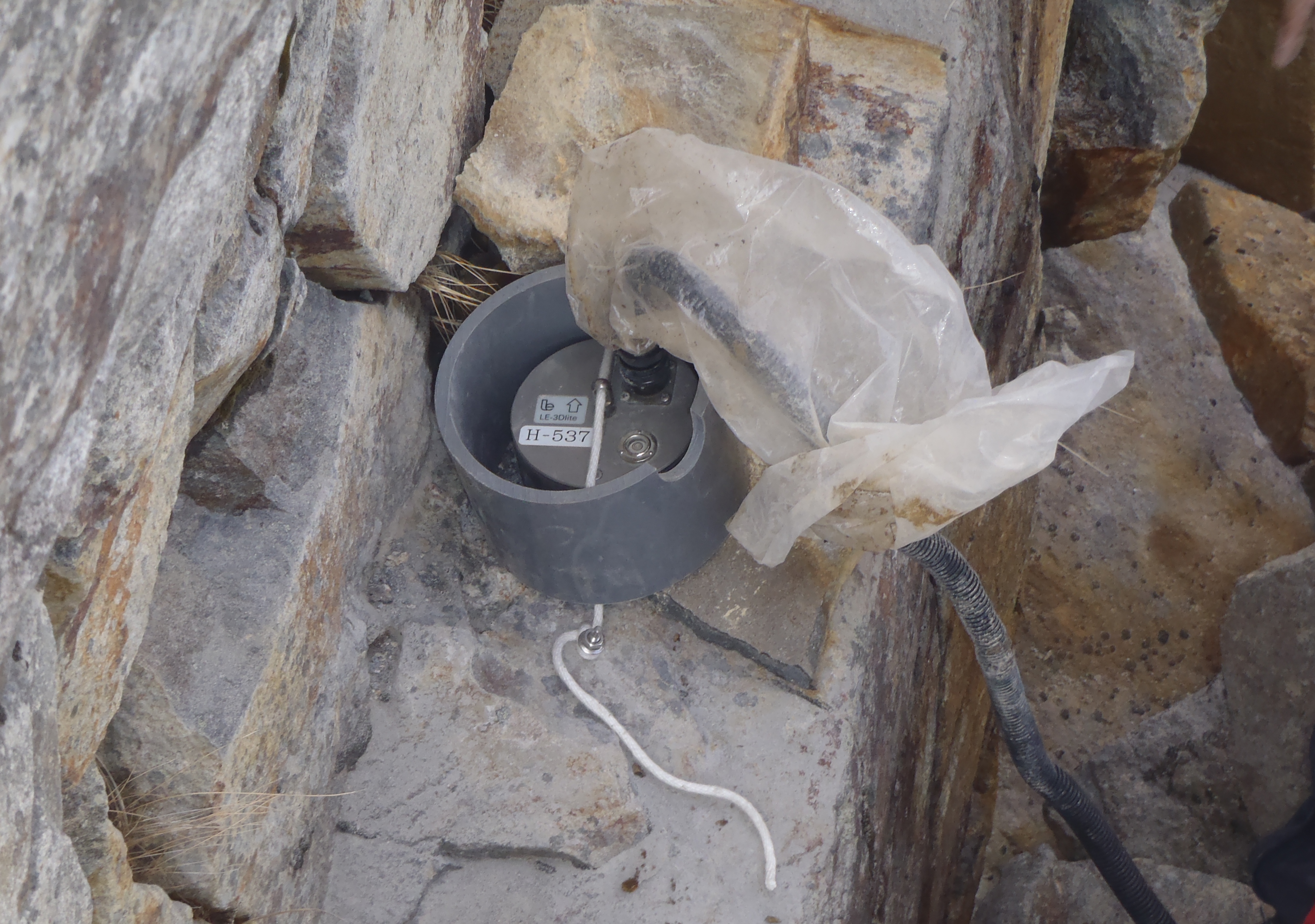
Seismic waves are phenomena in which the deformation of bedrock is transmitted underground in the form of waves. Not only so-called "earthquakes," but also ocean waves, vibrations of structures caused by wind, movements of people or vehicles, and any other phenomenon that exerts force on the ground can generate seismic waves. Most seismic waves are so small that they cannot be felt by the human body, but they can be measured using seismometers (Figure 1). Seismometers continuously record ground vibrations, producing an enormous amount of data—100 samples per second at a single observation point (→ 8,640,000 samples per day, 3,153,600,000 samples per year). By analyzing such data with computers, we can obtain information, for example, about the seismic source or force that triggered the waves, as well as details on the underground structure along the propagation path the seismic waves traveled before reaching the observation point.
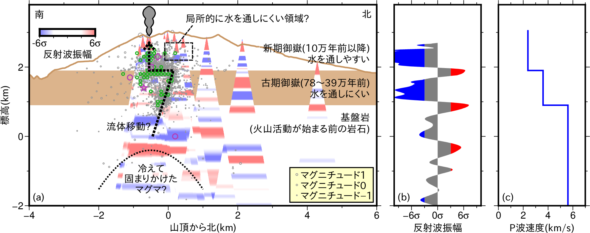
Mount Ontake is an excellent field for advancing seismic wave analysis. Although Mount Ontake is an active volcano, seismic activity occurs almost constantly in areas such as the summit (around the crater) and the foot of the mountain (Figure 2), and temporal changes in seismic activity associated with volcanic activity can also be observed (Figure 3). In other words, there is no shortage of research topics. Furthermore, since the installation of one of the world's most advanced high-density observation networks on Mount Ontake in the autumn of 2017, ultra-high-density monitoring of seismic activity has been continuously conducted (Figure 4). By using such data, it is possible to analyze seismic activity and subsurface structures at a level of accuracy and detail unattainable in other regions (Figure 5).
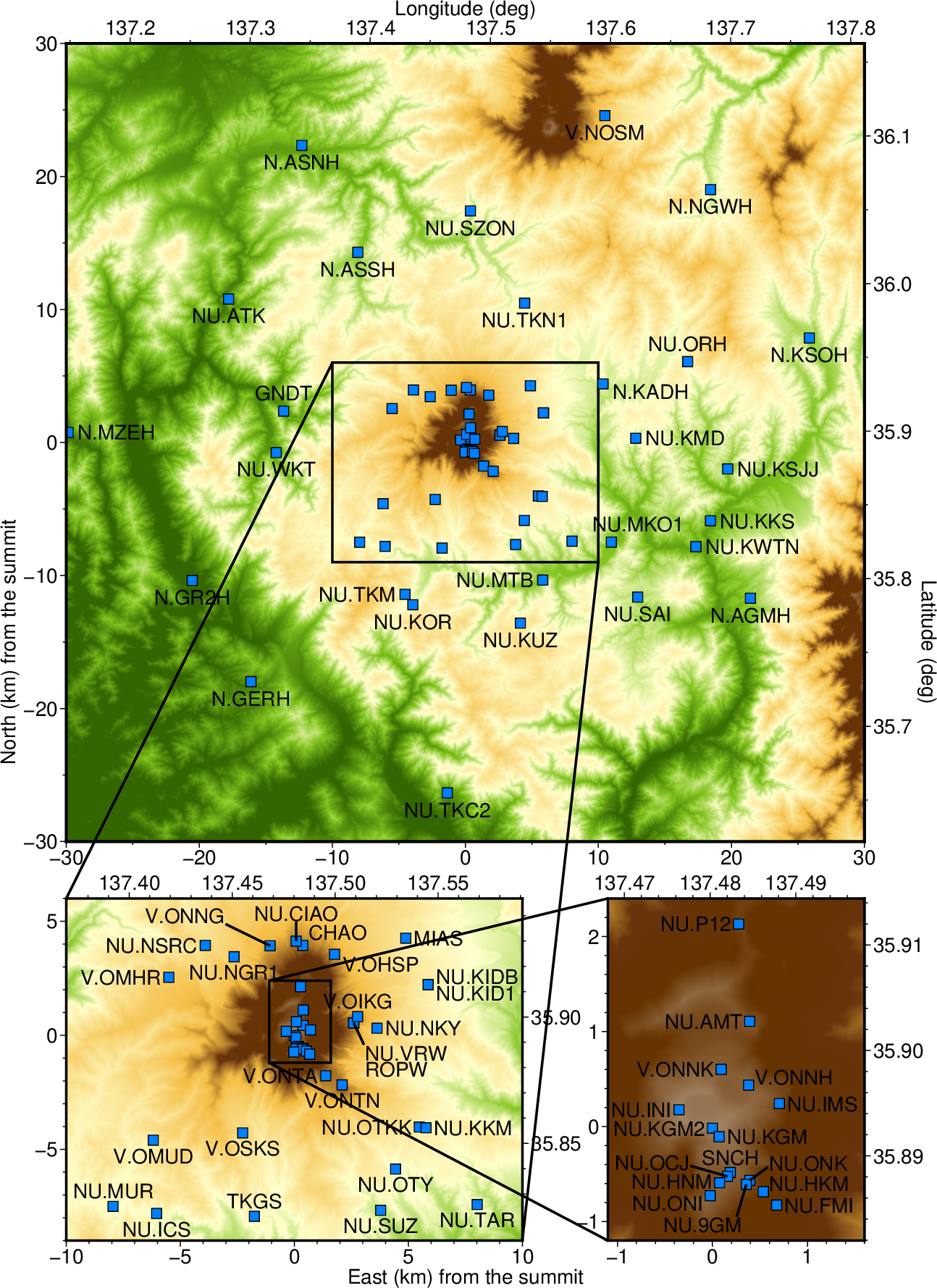
図2. 御嶽山山頂から東西南北25 km以内の地震の震源分布
(2024年7月〜2025年6月、名古屋大学による震源決定結果)。
御嶽山山頂域(図の中央部、おおよそ山頂から東西南北4km以内)と東麓で地震活動が特に多い。
Fig. 2. Hypocenter distribution of earthquakes within 25 km in all directions from the summit of Mount Ontake (July 2024—June 2025, based on hypocenter determinations by Nagoya University). Seismic activity is particularly high in the summit area of Mount Ontake (central part of the figure, approximately within 4 km of the summit) and on the eastern foot of the mountain.
[AI Translation by
Paperpal]
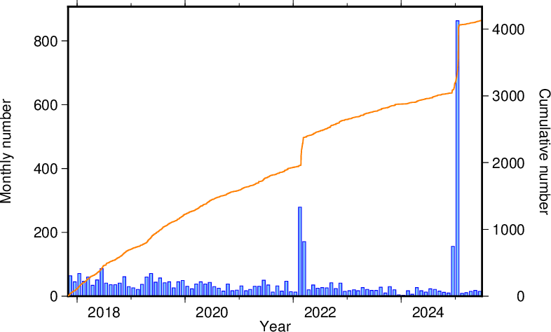
図3. 御嶽山山頂から東西南北4 km以内の地震の月別回数(青)と累積回数(橙)の推移
(2017年11月〜2025年6月、名古屋大学による震源決定結果)。
2014年噴火以降、山頂域の地震活動は長期的に見て徐々に減少傾向であるが
2022年2〜3月、2024年12月〜2025年1月には活発な地震活動が見られた。
Fig. 3. Monthly number of earthquakes (blue) and cumulative number (orange) within 4 km in all directions from the summit of Mt. Ontake (November 2017–June 2025, based on hypocenter determinations by Nagoya University). Since the 2014 eruption, seismic activity around the summit area has generally shown a gradual long-term decline, but increased seismic activity was observed in February—March 2022 and December 2024—January 2025.
[AI Translation by
Paperpal]
図4. 御嶽山山頂から東西南北30 km以内の地震観測点マップ。
水色の四角形が全て地震観測点。
現在は廃止された観測点を一部含むが多くは現在も運用されている。
Fig. 4. Map of seismic stations within 30 km north, south, east, and west of the summit of Mount Ontake. The light blue squares represent all the stations. Some of the stations shown are no longer in operation, but most are still active.
[AI Translation by
Paperpal]