About the Center
Instruments
Earthquake & Volcano Observations
The Earthquake and Volcano Research Center uses mainly observation techniques to carry out research on the elucidation of mechanisms and prediction of earthquakes and volcanic eruptions. For this purpose, the Center have many kind of observation instruments, including seismometers and GNSS. The Center's main instruments are shown below.
Observation Instruments - over view
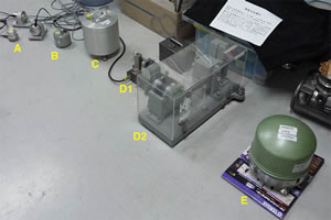
Various seismometers
There are varieties of seismometers. A-D: short period seismometers (A - natural frequency of 2Hz, B and C - natural frequency of 1Hz, D - old style seismometer), E: broadband seismometer able to measure slow oscillations.
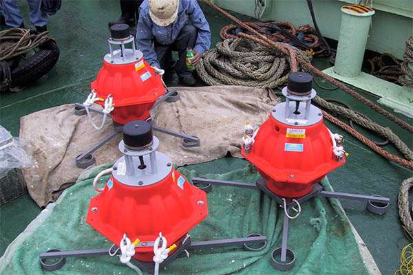
Instruments for sea floor geodetic
observations
If we can measure crustal movement under water, where electromagnetic wave cannnot penetrate, in the same way that the GPS system have achieve on land, we will be able to elucidate the movements in the plate boundary region that produces large earthquakes. For this purpose an instrument is placed on the ocean floor to measure the distance to the boats on the surface of the sea using sound wave signal. This photo shows the instrument being submerged to the ocean floor. It send back a sound wave signal immediately after it received a signal from the boat on the surface of the sea.
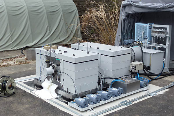
Accuretely controlable vibration source
ACROSS is a seismic vibration instrumet, which emits sinusoidal wave underground with an accureate synchronization to the exact times obtained from GPS signals. A remote seismometer receives the signal and the system thereby traces changes in subsurface structures over time. Changes in the propagation property of seismic wave are expected at a movement of magma in volcanoes or changes in the distribution of underground fluids. The photo shows the latest ACROSS seismic vibrator, installed at the Mikawa Observatory in Toyohashi City, Aichi.
Observation Instruments
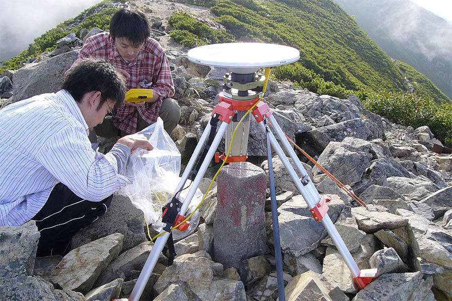
GNSS (GPS) observation instruments
The photo shows a GPS antenna. Installed at a long-lived, firmly fixed point such as a triangulation point, it receives radio waves from a GPS satellites mounted on a tripod. It repeatedly measures movement at that location with an accuracy to the order of millimeters.
Gravimeter
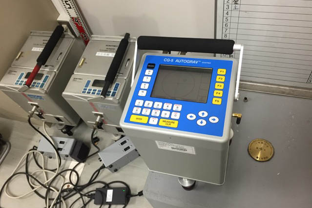
The Earthquake and Volcano Research Center also has three digital portable relative gravimeters which automatically record measurements. Two of the three are SCHINTREX made CG-3 devices (photo, left), while the other one is the latest model CG-5 (photo, right). Relative gravity measurement takes the gravitational level at a certain time or place as a reference point against which it measures gravitational changes. Because absolute levels of gravity are not required in the way an absolute gravimeter does, the measurement process can be largely simplified. Using the same equipment used in the research, students can conduct experiments using relative gravimeters and carry out their own observations and use the data to estimate the subsurface structure. Through such a practical training, students learn about gravity.
Data transmission instruments
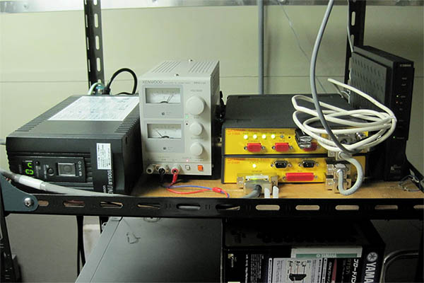
Real time recorded data is transmitted to Nagoya University from various sites. Photos, from left: UPS (uninterruptible power supply), direct current regulated power supply, data logger (data transmission instruments), modem. The data is converted into IP form and sent. Measurements need to be timed accurately and GPS are used as timekeeping devices.
Short period seismometers
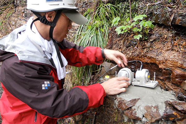
A view of the installation of short period seismometers. A 2Hz natural period seismometer was installed here to make observations on a temporary basis. Three seismometers are installed to mesure the vibration of the ground three dimensionally: up and down, east and west and north and south. The photo is taken at the installation of the second seismometer. The seismometers are connected to a data logger and the data is recorded in digital form.
Broadband seismometer
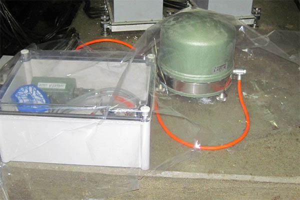
A seismometer that can measure tremors in equal seinsitivity ranging from short periods of 30 Hz to long period of up to 100 second. Seismic wave of a great earthquakes usually contains high energy in these long period range. Measurements from this sort of broadband seismometer are essential for understanding how great earthquakes work.
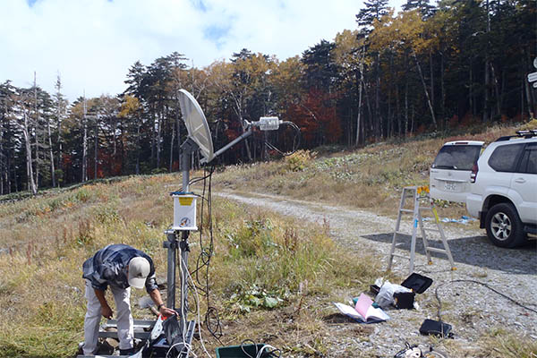
Satellite telemeter equipment
Signals from seismometers and GNSS are generally sent to Nagoya University via telephone lines. However, in places such as volcanoes where telephone lines can not be used, communications satellites are used instead to send the data. The photo shows the antenna used for sending data to the satellite. In 2014, in the aftermath of the Mt. Ontake eruption, it was installed in the foothills on the north side.


